The professional relocation of high-value maritime assets across the Australian coastline and toward Southeast Asian destinations like Singapore involves navigating one of the most regulated and meteorologically volatile maritime corridors in the world. For delivery skippers and vessel owners, the transition from recreational cruising to professional delivery necessitates a shift toward a cold, risk-focused operational methodology. This report provides a comprehensive analysis of regional operational risks, statutory requirements under the Australian Maritime Safety Authority (AMSA), and the environmental dynamics of major current systems and meteorological phenomena that define the Australian delivery theatre.
The delivery of a yacht along the Australian eastern seaboard is perennially influenced by the potential for rapid cyclogenesis. While tropical cyclones are a well-understood seasonal threat, the presence of East Coast Lows (ECLs) represents a more frequent and often less predictable hazard for maritime operations between southern Queensland and Tasmania.
East Coast Lows are intense, cold-core or hybrid low-pressure systems that develop off the eastern coast of Australia, typically between 20°S and 40°S. Unlike transient cold fronts that move rapidly across the continent, ECLs are characterized by their ability to remain slow-moving or near-stationary for durations exceeding 12 hours within 200 km of the coastline. This persistence leads to prolonged periods of hazardous conditions that can exceed the structural and operational limits of production yachts.
The formation of an ECL is driven by the interaction between a strong upper-atmosphere disturbance (located 10–15 km above sea level) and the warm surface waters of the East Australian Current (EAC). As a bubble of cold air moves over the warm current, the resulting temperature gradient triggers rapid deepening of the surface low. A defining characteristic of an intense ECL is a sharp pressure gradient, frequently dropping at least 4 hPa per 100 km toward the center. In cases of “explosive cyclogenesis,” also known as a “meteorological bomb,” central pressure can drop by 24 hPa in a single 24-hour period.
A critical operational factor in ECL risk management is the presence of a “cradling high”—a robust high-pressure system situated in the southern Tasman Sea. This high-pressure system acts as a geographic block, preventing the ECL from moving away from the coast and significantly tightening the pressure gradient on the southern side of the low. Consequently, wind speeds on the southern flank of an ECL can match or exceed the intensity of Category 1 or 2 tropical cyclones, with peak gusts historically recorded as high as 165 km/h.
| Parameter | East Coast Low (ECL) Characteristics | Operational Risk Level |
| Pressure Gradient | ≥4 hPa per 100 km | High: Drives sudden wind surges |
| Persistence | >12 hours within 200km of coast | High: Sustained stress on rigging/hull |
| Sea State | 15-meter waves possible in extreme cases | Extreme: Risk of foundering or structural failure |
| Rainfall | >250 mm in 24 hours possible | Medium: Reduced visibility/radar attenuation |
| Wind Strength | Up to 180 km/h (Category 2 equivalent) | High: Loss of steerage/mast failure |
The asymmetric cloud and wind patterns of ECLs mean that while the north side of the system may experience relatively clear skies, the poleward (southern) side will endure the heaviest rainfall and strongest gale-force winds. For northbound deliveries originating in Sydney, identifying the formation of an ECL is vital, as it necessitates immediate course alteration to seek shelter in high-quality marinas like Port Stephens or Coffs Harbour before the onset of the southern-flank surge.
The efficacy of a yacht delivery in Australian waters is directly tied to the skipper’s ability to interpret and utilize the primary current systems: the East Australian Current (EAC) on the east coast and the Leeuwin Current on the west coast.
The EAC is the dominant hydrodynamic force on the Australian east coast, transporting warm, low-nutrient water from the Coral Sea southward into the Tasman Sea. It is a surface-driven current, influenced by the South Pacific Gyre and the Coriolis effect.
Velocity and Dimensions: The EAC typically ranges from 15 km to 100 km in width and can reach depths of 500 meters. Surface velocities are highly variable but frequently reach 4 knots in the core of the current.
Separation Points and Recirculation: The main jet of the current generally remains attached to the continental shelf until it reaches latitudes between 30°S and 32°S (Coffs Harbour to Port Stephens). At this point, the current undergoes a complex separation process: approximately 38% of the time, the main flow separates between 32°S and 33.5°S, turning eastward to form the Tasman Front. The remaining energy continues southward as the EAC Extension, eventually dissipating into the Antarctic Circumpolar Current.
Eddy Generation: South of the separation point, the current manifests as a series of energetic mesoscale eddies, which can be 200–300 km in diameter. Warm-core eddies rotate anti-clockwise and can provide a significant southward boost for deliveries, while cool-core eddies rotate clockwise and must be avoided by southbound vessels.
For northbound deliveries toward Singapore, the EAC acts as a major source of resistance. Routing strategies must prioritize staying inshore of the 100-fathom line, where narrow counter-currents and land-breeze-driven zones can minimize headway resistance. Conversely, for southbound deliveries, the current is a “superhighway” that can significantly reduce transit times, provided the vessel is positioned correctly in the core of the jet.
The Western Australian coast is dominated by the Leeuwin Current, the world’s longest boundary current. It flows southward along the edge of the continental shelf, rounding Cape Leeuwin and extending as far as Tasmania.
Seasonal Variability: The strength of the Leeuwin Current is inversely related to the prevailing winds. It is weakest during the summer (November to March) when strong southerly winds oppose the flow. Its peak flow occurs during autumn and winter (March to November) when the opposing winds abate.
The Capes Current Counter-Flow: During late spring and summer, a cool, northward-flowing counter-current known as the Capes Current develops inshore, particularly between Cape Naturaliste and Cape Leeuwin. This current provides a critical window for northbound deliveries along the WA coast to avoid the southward energy of the Leeuwin Current.
Interannual Variability (ENSO): The Leeuwin Current is significantly weakened during El Niño years, leading to lower sea surface temperatures and reduced southward transport. During La Niña phases, the current strengthens, increasing the transport of tropical larvae and heat southward.
Vessels moving between the East and West coasts must navigate the Great Australian Bight, an area defined by some of the most consistent and powerful swell patterns globally. The Bight’s circulation is driven by eastward winds in winter and the eastward shelf-edge Leeuwin Current.
Risk management in the Bight focuses on identifying periods of “long-period” swells (15–20 seconds) which can generate hazardous sea states even in the absence of local wind. For eastbound transits, mariners are advised to wait for the arrival of winter westerlies, while summer transits require extreme patience to wait for the passage of easterly gales followed by veering northeasterlies.
| Region | Primary Current | Core Direction | Typical Peak Velocity | Seasonal Peak |
| East Coast | EAC | Southward | 4.0 knots | Summer |
| West Coast | Leeuwin | Southward | 3.5 knots | Autumn/Winter |
| SW Coast | Capes | Northward | 1.0 – 1.5 knots | Summer |
| Bight | S. Australian | Eastward | 0.5 knots | Winter |
The Great Barrier Reef (GBR) and Torres Strait represent a complex regulatory environment where navigational errors can result in catastrophic environmental damage and severe legal penalties. The region is designated as an IMO Particularly Sensitive Sea Area (PSSA), allowing for additional protection measures that are legally binding for all vessels.
The Great Barrier Reef Marine Park Authority (GBRMPA) manages the region via a strict zoning plan. Commercial and “regulated” ships are generally restricted to the Designated Shipping Area (DSA) or General Use Zones.
DSA Boundaries: The DSA covers approximately 80% of the Marine Park and is designed to accommodate vessels using accepted, normally used routes. Navigating outside these areas without a permit is a breach of the GBRMP Zoning Plan 2003.
Private Yacht Flexibility: Smaller yachts (<50m) have broader access to various zones but must adhere to specific site-management rules. For example, in the Cairns Planning Area, anchorages are limited based on vessel size, with specific restrictions for yachts between 35m and 70m.
No-Anchoring Zones: These are typically marked with white pyramid-shaped buoys. Anchoring within these zones or on coral is strictly prohibited and monitored.
Under the Navigation Act 2012, coastal pilotage is mandatory for specific categories of vessels in five compulsory pilotage areas: the Inner Route (Cape York to Cairns), the Great North East Channel, the Torres Strait, Hydrographers Passage, and the Whitsundays.
Vessel Thresholds: Pilotage is compulsory for any vessel with an overall length (LOA) of 70 meters or more. It is also mandatory for all loaded oil tankers, chemical carriers, and liquefied gas carriers, regardless of their length.
Legal Implications: The failure to carry a licensed pilot is a “strict liability” offense. This means the prosecution does not need to prove intent or negligence; the mere fact of the vessel being in a restricted area without a pilot is sufficient for conviction. Penalties can reach $85,000 for individuals and significantly higher for corporate entities.
Pilot Boarding Locations: For eastbound transits through the Torres Strait, pilots typically board at Booby Island (for draughts ≥ 8m) or Goods Island (for draughts < 8m).
The Reef Vessel Traffic Service (ReefVTS) provides continuous monitoring of vessel traffic through the GBR and Torres Strait.
Participation Requirements: Participation is mandatory for all vessels ≥ 50m LOA, all tankers regardless of length, and any vessel engaged in a towing operation where the total length of the tow exceeds 150m.
Reporting Protocol: Participating vessels must submit an Entry Report (ER) when entering the ReefVTS area or departing a port within it. This report includes the ship’s name, call sign, current position, planned speed, and route information.
Position Monitoring: ReefVTS uses AIS, radar, and Automated Position Reports (APR) via Inmarsat C. If a vessel is unable to provide APR, it must provide manual position reports every hour.
Navigational Assistance: ReefVTS personnel may contact a vessel if it is observed heading into shallow water or deviating from a recommended shipping route.
A fundamental risk in professional yacht delivery is the misclassification of the voyage’s regulatory status. In Australia, the distinction between a recreational voyage and a commercial delivery is defined by the remuneration of the crew.
If a person is paid to operate the vessel or acts as a member of the crew for reward, the vessel is categorized as a Domestic Commercial Vessel (DCV) under the Marine Safety (Domestic Commercial Vessel) National Law Act 2012. This triggers a suite of legal obligations for the owner and the master:
Unique Vessel Identifier (UVI): The vessel must be registered with AMSA and display a UVI.
Certificate of Survey: The vessel must demonstrate it meets specific design, construction, and safety equipment standards.
Certificate of Operation: This document outlines how and where the vessel may be operated.
Safety Management System (SMS): The owner is legally required to implement and maintain a written SMS that details risk management and emergency procedures.
Effective January 1, 2023, AMSA implemented the revised Marine Order 505, which introduced new certificates of competency (CoCs) specifically designed for the professional yachting and sailing industry. These new “tickets” allow for a more streamlined transition for skippers holding RYA (Royal Yachting Association) qualifications into the Australian commercial framework.
| New CoC (MO 505) | Maximum Vessel Length | Operational Area | Required Base Qualification |
| Sailing Master Coastal | <24m | Inshore waters | RYA Yachtmaster Coastal |
| Sailing Master Offshore | <24m | Within the EEZ | RYA Yachtmaster Offshore |
| Master <24m NC | <24m | Within the EEZ | Cert III Maritime Ops |
| Master <45m NC | <45m | Within the EEZ | Replaces Master <35m |
| Coxswain Grade 3 NC | <12m | Inshore (Daylight) | New entry-level ticket |
For international deliveries, such as a Sydney-to-Singapore transit, skippers must generally hold an STCW-endorsed Master of Yachts 200gt or higher, and the vessel must be recorded on the Australian General Shipping Register to receive diplomatic protection and meet international port state control requirements.
Under the new framework, all CoC applications—including renewals—require a “Certificate of Medical Fitness for Domestic Seafarers” (AMSA Form 1850). Furthermore, skippers must hold a current Marine Radio Licence, with a “Long Range Operator Certificate of Proficiency” (LROCP) mandatory for Offshore qualifications.
The logistics of a yacht delivery from Australia to Singapore are governed by strict customs and biosecurity protocols. The master of the vessel is legally responsible for ensuring that all departure and arrival notifications are completed accurately and within specified timeframes.
When a vessel departs Australia for a destination beyond the seas, it is treated as an export.
Export Declaration (EDN): An Export Declaration must be lodged with the ABF to obtain an Export Declaration Number (EDN). This declaration provides the ABF with details of the vessel’s value, ownership, and destination.
Vessel Registration: It is a legal requirement for all Australian-owned vessels to be registered on the Registrar of Ships before departing for overseas. State registration is insufficient for international clearance.
Customs Clearance: The master must contact the ABF at an appointed port of departure to obtain a “Certificate of Clearance”. Departing without this clearance is an offense.
Ship’s Gear and Equipment: To avoid paying import duty upon the vessel’s eventual return to Australia, residents should list all owned yachting equipment with the ABF at the port of departure.
Australia maintains some of the world’s most stringent biosecurity controls, which apply to all arriving vessels including private yachts.
Pre-Arrival Report (PAR): Since December 2023, all non-commercial vessels arriving in Australian territory must submit a PAR through the Department of Agriculture’s web portal. This report must be submitted between 90 days and 12 hours before arrival.
Notice of Impending Arrival: The master is required by law to provide notice of arrival no later than 96 hours before entering port.
Pratique Procedures: While entering Australian waters, the vessel must clearly display the International Pratique Q-flag (yellow) and proceed directly to an appointed boarding station. No person or animal may leave the craft until biosecurity and customs clearance is granted.
Deliveries toward Singapore typically transit via the Lombok Strait or the Sunda Strait.
Spare Parts Logistics: A major operational risk involves machinery failure in Indonesian waters. Shipping marine parts into Indonesia is often delayed by months and subject to duties as high as 40%, even for vessels in transit. Consequently, delivery skippers must carry an extensive inventory of critical spares, including exhaust elbows, impellers, and fuel filters.
Security Concerns: While the major shipping lanes are generally secure, the Malacca Strait presents risks related to heavy commercial traffic, unlit fishing vessels, and potential piracy in specific sectors.
Insurance for offshore deliveries is contingent upon the vessel’s compliance with seasonal and geographic warranties. In Australian waters, the primary focus is on “Named Tropical Storm” (NTS) cover.
Most major marine insurers, including Pantaenius, implement specific clauses for vessels operating in Northern Queensland and the Coral Sea.
Geographic Boundary: NTS cover is typically restricted or subject to additional premiums for vessels operating north of Gladstone.
Swing Mooring Exclusion: Insurers generally refuse to provide NTS cover for vessels kept permanently on swing moorings north of Gladstone during cyclone season.
Contingency Planning: For vessels up to 80 feet (LOA), insurers mandate a formal “Named Tropical Storm Contingency Plan” that aligns with Queensland Government maritime safety requirements. Vessels exceeding 80 feet LOA are often required to relocate entirely from the impact zone of a named storm.
Premium Impacts: Cruising in Queensland waters during the higher-risk periods typically increases the hull premium by approximately 10% per annum.
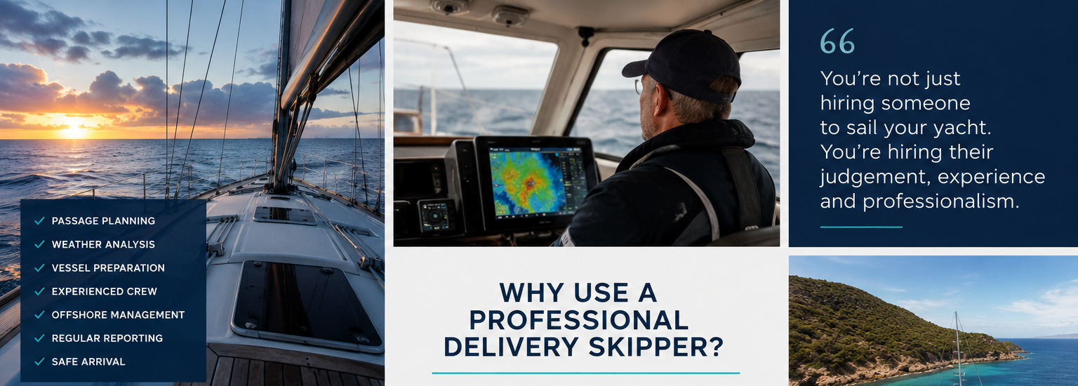
Following the ‘Yacht Delivery Solutions’ editorial guidelines, a delivery is only as successful as the pre-departure preparation. Professional skippers employ a rigorous “no-sail” checklist to mitigate the risk of mid-passage failure.
Flooding and Dewatering: Mandatory testing of automatic float switches and manual overrides. Manual bilge pumps must be operated to confirm sustained suction and discharge capacity.
Structural Securement: All heavy items, including batteries, gas bottles, and anchors, must be secured to a “180° knockdown” standard to prevent them from becoming projectiles in heavy weather.
Propulsion Integrity: Cooling system reliability is paramount. This includes inspecting the exhaust elbow for corrosion and ensuring redundant drive belts and impellers are on board.
Communication Redundancy: Continuous satellite tracking (e.g., Iridium or Starlink) is required to provide the owner with real-time position updates and for the skipper to receive updated GRIB (meteorological data) files.
The transit from Sydney to Singapore involves a multi-layered risk landscape that changes significantly as the vessel moves north.
| Segment | Primary Operational Risk | Management Strategy |
| Sydney to Brisbane | East Coast Lows (ECLs) | Daily BOM synoptic analysis; stay inshore of EAC core |
| Brisbane to Cairns | Coral Sea Navigation/Zoning | Use Eye on the Reef app for zone checks; avoid no-anchoring areas |
| Cairns to Darwin | Torres Strait/Trade Winds | Monitor for SE trade surges; participate in ReefVTS (>50m) |
| Darwin to Lombok | Indonesian Customs/Logistics | Pre-purchase all engine spares; verify transit visas |
| Lombok to Singapore | High-Density Shipping/Piracy | Continuous 24h bridge watch; AIS active; stay clear of fishing fleets |
Scientific data indicates that while the total frequency of ECLs may decrease by the end of the century, the intensity of the events that do occur is projected to increase. This trend toward more destructive wind speeds and higher rainfall rates will likely lead to more stringent insurance requirements and narrower weather windows for professional deliveries. Furthermore, the ongoing southward expansion of the East Australian Current will continue to alter traditional routing strategies, potentially pushing the EAC separation point further south and increasing the frequency of high-energy eddies in the southern Tasman Sea.
The professional delivery of a yacht within or from Australia requires a disciplined integration of meteorological forecasting, oceanographic interpretation, and strict regulatory adherence. The implementation of AMSA Marine Order 505 has provided a clear, albeit rigorous, pathway for professional skippers to ensure legal compliance, particularly regarding the commercial status of paid deliveries.
Skippers should prioritize staying inshore of the EAC core when northbound to minimize fuel consumption and headway resistance. In the GBR, the strict liability nature of pilotage laws means that vessel length and draught must be verified against current charts (AHP20) to avoid significant fines and potential vessel detention. For international transits, the use of a customs broker to manage the Export Declaration (EDN) and the 96-hour arrival notice is recommended to minimize administrative delays at both the ABF and the destination port.
Ultimately, the ‘Yacht Delivery Solutions’ approach—defined by transparency, direct skipper-to-owner communication, and comprehensive vessel preparation—remains the most effective framework for managing the high-value risks inherent in Australian and Southeast Asian maritime relocations.